Flying Near Airports and NOTAMs How to Check Restricted Airspace
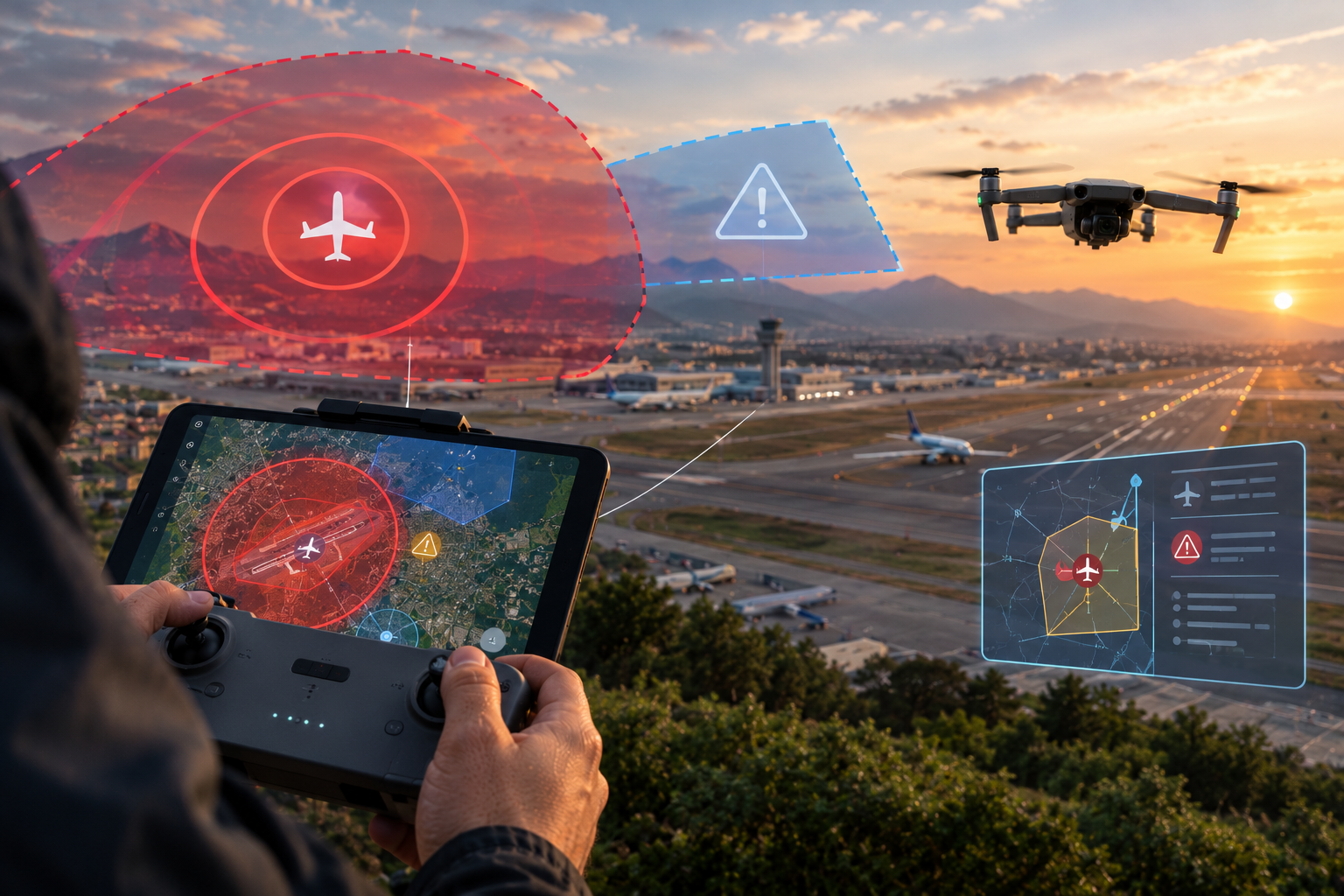
A lot of the legal trouble drone pilots get into does not come from flying mistakes. It comes from not checking carefully where they were about to fly. A job a few miles from an airport, a stadium with a game that afternoon, a temporary restriction for a wildfire, or a visit from a senior official can turn a routine flight into a serious violation. The good news is that almost all of it can be checked before you leave the house, using free official tools.
In this article I explain how airspace restrictions around airports work, what NOTAMs and TFRs are, which other special areas you need to know about, and which tools I use to check everything before each flight. I already have a dedicated article on LAANC, so here I mention it only as part of the process. The goal is to give you a clear verification routine so you are never relying on a single app to make the call.
The Airspace Around Airports
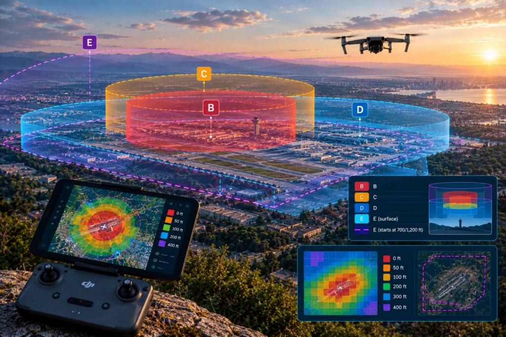
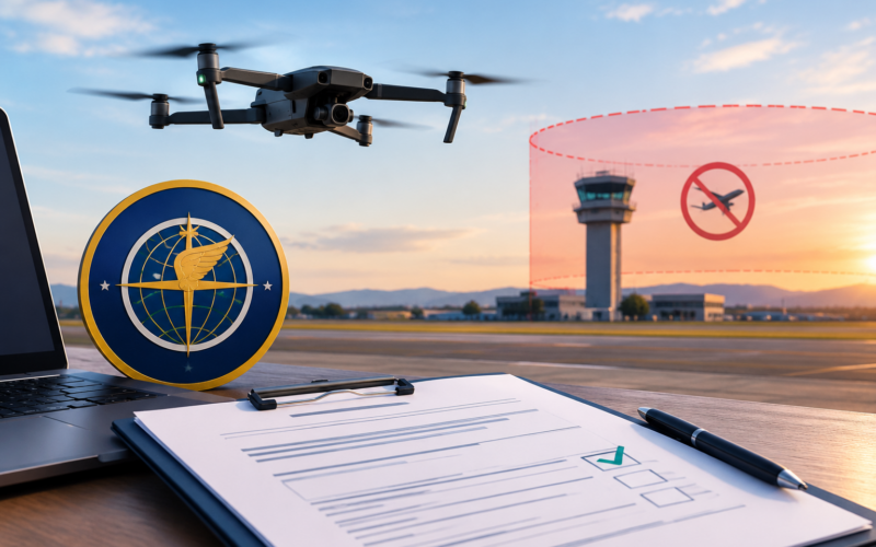
Most towered airports are surrounded by controlled airspace: Class B at major airports, Class C at mid-size airports, Class D at smaller towered fields, and in some cases Class E that extends down to the surface. Under 107.41, you may not operate in Class B, C, or D airspace, or within the lateral boundaries of the surface area of Class E airspace designated for an airport, without prior authorization from air traffic control.
In practice you get that authorization through LAANC almost every time, with near-real-time approval up to the altitudes shown on the FAA’s UAS Facility Maps. Those maps divide the area around an airport into grid cells, each with a maximum altitude that can be authorized: 0, 50, 100, 200, 300, or 400 feet. If you need to go higher than the grid allows, or LAANC is not available at that location, you submit the request through FAA DroneZone, and it takes longer.
A common mistake is confusing surface Class E with Class E that begins at 700 or 1,200 feet AGL. The latter covers much of the country, but because it starts above the 400 feet you normally operate in, it does not require authorization for typical Part 107 flights. What you need to identify is whether your location sits inside Class E that extends to the surface, shown on sectional charts with a dashed magenta line.
Non-Towered Airports and Heliports
In Class G airspace you do not need authorization, even with an airfield nearby. That does not mean you can ignore it. Section 107.43 prohibits operating in a way that interferes with operations and traffic patterns at any airport, heliport, or seaplane base. Near a non-towered field, I identify the runway, the traffic pattern direction, and the approach and departure paths, and I stay clear of them. Hospital heliports deserve special attention, because medical helicopters fly low and can show up with no warning.
What NOTAMs Are and Why They Matter to You
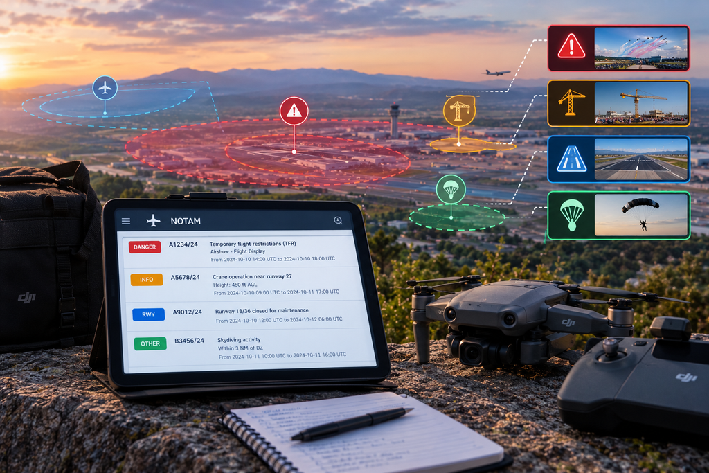
A NOTAM (Notice to Air Missions) is an official notice about temporary changes or conditions that affect flight safety: runway closures, new obstacles such as cranes, lighting outages, procedure changes, special activities, and temporary flight restrictions. Many NOTAMs are aimed at manned aviation, but several directly affect drones, especially those establishing airspace restrictions.
As a Part 107 pilot, 107.49 requires you to assess the operating environment before flight, and that includes knowing the airspace restrictions in effect where you plan to fly. Looking at an airport map is not enough. You need to confirm whether there is an active NOTAM restricting flight at the time and place you will operate. NOTAMs have start and end times, usually in UTC, so get in the habit of converting to your local time zone to avoid mistakes.
NOTAMs can also give you useful information even when they do not prohibit anything. A crane notice near your job site, skydiving activity, or an aerial event helps you anticipate risk and plan the operation better. That is why I read through them fully instead of scanning only for prohibitions.
TFRs: Temporary Flight Restrictions
Temporary flight restrictions are issued by NOTAM and prohibit or limit flight in an area for a set period. They apply to drones too, and flying inside a TFR without authorization is one of the most serious violations you can commit, with potential civil penalties and, in some cases, criminal charges. The ones a drone pilot runs into most often are these:
- Disasters and emergencies (91.137). Wildfires, floods, or accident scenes where emergency aircraft are working. A drone over a wildfire can force aerial firefighting to stop.
- Presidential and VIP security (91.141). Large-radius restrictions around the location of the President or other senior officials, which can appear on short notice.
- Space operations (91.143). Launches and reentries of space vehicles.
- Aerial demonstrations and major events (91.145). Air shows and certain sporting events.
- Stadiums (99.7). A standing restriction for certain sporting events at large stadiums: 3 nautical miles and 3,000 feet AGL, from one hour before to one hour after the event.
The stadium restriction deserves a special mention because it does not always show up as a separate temporary TFR, and many pilots miss it. It covers events such as major professional league games, NCAA Division I football, and certain motorsports events at high-capacity venues. If you will be flying near a stadium, always check that day’s event schedule.
A TFR can be issued just hours before your flight. What you checked yesterday does not count today: verify the same day and right before takeoff.
Other Special Areas You Need to Know
Beyond airports and TFRs, some areas carry permanent restrictions. The Washington, D.C., area has a Special Flight Rules Area extending roughly 15 nautical miles around Reagan National Airport, within which drone flight is prohibited without specific authorization, with an even more restrictive inner zone. There are also prohibited and restricted areas, military operations areas, and national security areas over certain military and critical infrastructure facilities where the FAA has set specific drone restrictions.
Do not forget that some restrictions have nothing to do with the FAA. Many national parks prohibit launching and landing drones within their boundaries, and some states and municipalities regulate takeoff from their property. Those rules do not control the airspace, but they do control where you can stand. For commercial work I check both: whether I can fly in that airspace and whether I can launch from the spot I picked.
Official Tools to Check Before You Fly
There is no single perfect tool, so I combine several and compare what they show. FAA sources are the foundation, and third-party apps help me see everything on a map quickly. If two sources disagree, I go with the more restrictive one until I sort it out.
- B4UFLY. The FAA’s official app, built with approved partners, which shows at a glance whether there are restrictions at your location. It is aimed mainly at recreational flyers but works well as a first filter.
- LAANC providers. They display UAS Facility Map grids and TFRs and let you request authorizations.
- tfr.faa.gov. The official list of active and scheduled TFRs, with maps and details for each restriction.
- FAA NOTAM Search. Lets you look up NOTAMs by airport or location.
- 1800wxbrief.com. The flight briefing service, which pulls together weather, NOTAMs, and TFRs for an area.
- Sectional charts. Essential for understanding airspace structure beyond what any app shows you.
A note for DJI pilots: in the U.S., DJI changed its zone system in 2025 so that many restricted areas show up as warnings instead of blocking takeoff. That means the aircraft may take off in places where it previously would not, which puts even more of the verification burden on you. Never treat the absence of a lock in the app as proof that a flight is legal.
My Pre-Flight Verification Routine
Verification works best as a fixed routine rather than a one-off effort. I break it into three stages: when I plan the job, on flight day, and on site right before takeoff. Each stage has its own purpose, and skipping one is exactly when surprises show up.
- Planning. Identify the airspace class on a sectional and in a LAANC app, check the grid altitude, look for nearby airfields and heliports, stadiums, and special areas, and confirm local launch rules.
- The day before and the day of. Check tfr.faa.gov and the NOTAMs for the area, then repeat the check the morning of the flight.
- Controlled airspace. Request LAANC authorization for the right time window and save it somewhere accessible offline.
- On site. Check TFRs and NOTAMs again right before takeoff, watch for air traffic, and confirm nothing has changed.
- Record it. Log what I checked and which sources I used, along with any authorization.
That final record might seem minor, but it is valuable. If an inspector or your insurer ever asks how you checked the airspace, timestamped screenshots and the matching authorization show professional diligence. Over time it also helps you spot patterns in the areas where you fly most often.
My Recommendations for Flying Near Airports With Confidence
Flying near airports and in restricted areas is entirely doable if you approach it methodically. The key is understanding how airspace is structured, not just reading colors in an app, and assuming the information will change: TFRs pop up on short notice and NOTAMs are updated constantly. That is why verification needs to happen the same day and as close to takeoff as possible.
My final advice is to never rely on a single source, to keep evidence of your checks, and to stay on the ground until any doubt is resolved. A canceled flight can be rescheduled; a TFR violation or an incident with a manned aircraft cannot be undone. For any question about airspace, authorizations, or restrictions, the source that counts is the FAA at faa.gov/uas and the official list at tfr.faa.gov.
Author: Armando Colina Rojas
Comments
Comments are closed.